Category Archives: Cool New Projects

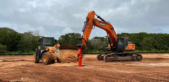
We’re very pleased to be supporting Weeks Marine on a dock-building project in Corpus Christi.  I don’t have a photo pass, so I can’t share with you pictures of the work.  It’s a fantastic site, though. I took this photo looking away from the site at the start of our shift this past weekend and thought it was worth sharing.

I just started work on a piledriving project where the GT of Record provided final tip elevations, based on 16 indicator piles, for the Contractor’s use in casting the design lengths. With the diagram he included a disclaimer that the site is variable, and that many of the piles might be different lengths in order to satisfy the acceptance criteria. The GT, accompanying the final design information, recommends that the Contractor hire another geotechnical engineer to monitor each production pile and make appropriate length adjustments, and also a structural engineer to design splices.  Without intending, I’m sure, the Owner’s engineer has converted the piledriving part of our project from conventional design-bid-build to a contract that relies on the Observational Method.

The Observational Method is extraordinarily effective on challenging sites, but also can be costly to implement. We use it explicitly on dams and tunnels. Ralph Peck’s 1969 Rankine lecture is, in my opinion, the best summary of the method’s origins, the rigor with which it is to be applied, and it’s significant advantages on projects with terribly difficult geotechnical conditions. Like all Rankine lectures, the paper is worth a read.  You can get your own copy here:

https://www.britishgeotech.org/prizes/rankine-lecture

I link to the full catalogue; scroll down to 1969.  Consider browsing a bit while you’re on the site. And yes, the photo that accompanies this post is my preferred headshot of Karl Terzaghi, not the author. Read Prof. Peck’s paper to understand why.

In my practice I find it helpful to recognize when the design team’s RFI responses induct elements of the Observational method into our project. When they do, it’s time to  evaluate whether or not the character of project has changed fundamentally from the project described in the bid documents. A conventionally procured project offers certainty in exchange for hard bid pricing. Other tendering formats are appropriate for projects where final design will be developed as conditions emerge, as is the case with the Observational Method.

It’s necessary to understand the Method in order to recognize unintentional implementations. Here’s a clip from Prof. Peck’s lecture, for those of you with just passing curiosity.

REVIEW OF METHOD

In brief, the complete application of the method embodies the following ingredients.

  • Exploration sufficient to establish at least the general nature, pattern and properties of the deposits, but not necessarily in detail.
  • Assessment of the most probable conditions and the most unfavourable conceivable deviations from these conditions. In this assessment geology often plays a major role.
  • Establishment of the design based on a working hypothesis of behaviour anticipated under the most probable conditions.
  • Selection of quantities to be observed as construction proceeds and calculation of their anticipated values on the basis of the working hypothesis.
  • Calculation of values of the same quantities under the most unfavourable conditions compatible with the available data concerning the subsurface conditions.
  • Selection in advance of a course of action or modification of design for every foreseeable significant deviation of the observational findings from those predicted on the basis of the working hypothesis.
  • Measurement of quantities to be observed and evaluation of actual conditions.
  • Modification of design to suit actual conditions.

The degree to which all these steps can be followed depends on the nature and complexity of the work.

I am particularly fond of that last statement. “It depends.” In the 50 years since those words were penned by one of the giants in our field, consulting geotechnical engineers have yet to address the fact that, really, the right course of action depends on the nature an complexity of the construction. There is always a way forward, of course, eVen in the most difficult conditions. The level of effort, though, depends on the nature and complexity of the work.


It’s been an interesting week here at Atlas Geotechnical World Headquarters. Our project in Seattle is standing down while Equipment Operators Local 302, who struck last week, continue negotiating a fresh labor agreement with the Associated General Contractors. Three timezones to the left, our project supporting new friends WW Clyde Company in Hanapepe is shut down by Hurricane Lane.

The hurricane, and attendant drenching rains, are on my mind because this afternoon’s task is analyzing hydraulic rise caused by installing bulkhead walls that allow driving access out to the in-water bents. Crane loads during demolition and foundation drilling are legitimately heavy, and the site is crowded, so getting equipment into position has turned into a significant effort.

I include some snapshots from my visit to the site last week. The existing bridge is a graceful reminder of classic Corps of Engineers construction. Built in 1938 for the Territory of Hawaii government, it’s provided reliable service for more than 8 decades.  The replacement bridge will be higher, wider, and safer.  Plus it’ll be free of the weight restriction that is causing difficulties for the re-opened aggregate quarry just a couple of miles up the road.

The temporary bridge is already in place, courtesy of Hawaiian Dredging Company, though the connecting diversion embankments remain for WWC to install.  Our good friend Gary Coover at Pryzm Consulting has the lead on geometric roadway design and utility relocation onto the temporary bridge.  We’ll lend a hand with a very narrow MSE embankment design, but we’ve also got our hands full with crane access designs for demolition and construction.

One last note:  The pipe piles in the photo at right, which support the temporary bridge, were intended to drive 40 or 50 feet into the “compact mud-rock” stated on the 1937 boring logs (I do so love the very effective diction in older plansets). The existing bridge is supported on untreated timber piles 35 to 40 feet long.  Surprisingly, PDA testing during of the pipes showed very low capacity through that known bearing layer.  The pipe pile in the photo is 140 feet long, as long as the planned new bridge shafts. Work in the Islands is just filled with surprises.

Everyone stay safe through the storm, please, and we’ll pick up where we left off once the floodwaters recede.

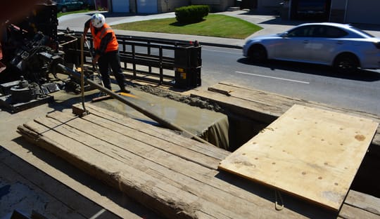
I spent a very pleasant Saturday morning with the GeoStabilization crew as they wrapped up shotcreting the face of their Lower San Antonio Road landslide repair while I ran the nail capacity performance test.  The site is surprisingly far east to still be in Santa Clara County, past Lick Observatory by almost an hour on a beautifully scenic winding road. The test setup is pretty simple, as you can see above, and the loads are modest enough that simple cribbing on soil provides enough reaction force.  We’re really enjoying this on-call collaboration with GSI and I’m angling for a way that I can cover the next testing assignment.

Wes and I are in upstate New York kicking off foundation drilling for the new valve chamber at Gilboa Dam.  The temperature was 14 F and falling when we walked out of the terminal at Albany International, and the light snow that we drove through is apparently just the prelude to a  10″ snowfall forecast for this Tuesday. We were hoping to move the big drill rig down the steep access ramp to the chamber floor on Tuesday, so we spent some time this afternoon making a different plan.

I learn new things every time I travel, and this trip is filled with opportunities to expand my view of the world. For instance, I learned that engineers who mainly work in the tropics can bring all of their warmest clothes and still be woefully unprepared for foundation construction in really cold weather.  I also learned that there’s a Walmart just about everywhere, and they have the stuff you need so that you can show up ready-to-work on Monday morning. I also learned how terrible is the iPhone camera at photographing the moon. The photo above is a poor representation of the gorgeous full moon reflecting off of the snowy field behind our house. It’s really quite stunning, and also small crystals of snow are falling frozen from a clear sky when you gaze up at the moon. The rural part of upstate New York is quite beautiful, and is populated with friendly and engaging people.

Speaking of friendly and engaging people, the best lesson of the day was how to thaw a frozen water pump in record cold temperatures. At right is a photo of Jimmy and his helper (or possibly Jimmy was the helper, it wasn’t at all clear) running a 50,000 BTU salamander heater into the CMU pump vault outside our kitchen.  They assembled a short section of 8″ chimney flue pipe on each end of a 90 degree elbow to direct the blast of hot air downward into the vault.  It took more than an hour to drive up to Cobleskill and back for the ducting, but then only about 10 minutes to melt the ice that was blocking the supply pipe. It was like a beach bonfire standing there. The minor inconvenience of losing plumbing for a half-day was negligible compared to the delight of chatting with Jimmy about the odd cold-weather problems that he had already repaired that day.

Tomorrow we meet with Southland/Renta, the general contractor, and the Owner’s team of engineers and inspectors.  We hope to be installing our test caisson on Thursday morning, even allowing for a little snow delay, and will go into production work soon after.


Sunset over Majuro lagoon

I’ve had a very productive week here on Majuro, the principal island in the Republic of the Marshall Islands. Our longtime collaborator Lyon Associates invited us to join their team for a Sea Grant project focused on developing a suite of  best practices for shoreline protection around the Marshalls, where land uses range from dense urban in downtown Uliga to rural in Laura, at the other end of the long island.

Really, this is a capacity building exercise focused on increasing efficiency and reliability of small-scale projects implemented by homeowners, who are getting specialty advice from contractors and regulators about appropriate and affordable shoreline protection.  There are a lot of stakeholders with different interests and a huge range of site and wave loading conditions, the perfect conditions for high-quality consulting. It’s gratifying to be working on such an important project.

I’ve been struck by how much of urban Majuro is already protected by well-built shoreline protection. Keeping tide and waves out of dwellings and off of city streets is plainly an important priority that lays claim to a significant fraction of limited local resources.  And while many lots have stabilized shoreline, some have not yet been addressed.  From infill seawalls (below) to increased setbacks and soft beach-sand berms, we’re hopeful that we can develop a useful set of best practices that facilitate safe and comfortable life on this low-lying atoll.

Urban shoreline retreat

A brief post this afternoon because it’s been a long day at Hilo Harbor. One of the most common questions people ask me about wharf construction is “how do you get the piles in the correct locations? It’s a good question, because you can’t really use a tape measure from shore, and the surveyor would have to wear water wings to mark the spot. The solution is a lot more work, but is the only way to accurately place the wharf piles in the correct spot: We build a falsework structure and place a template on it. And by measuring really carefully to be sure that the template is in place, we know that every pile that we drive through the template will be in the correct location too.

img_1187This photo has a pretty busy background, which is an unavoidable part of taking action shots of really big equipment in a crowded busy port, but if you look carefully you can see the 999 lowering a 40-ft long template that has positions for driving 20 wharf piles. The surveyor (in a red shirt under his PFD) is walking back to his equipment, which is set up over a very carefully marked spot on the template.  If that spot is in the correct location, then the template is correct. And if the template is correct, then we’re ready to drive piles with confidence. All of the rough-looking steel beans and pipe piles are temporary, and are only there to support the all-important template.

So, tomorrow, if all goes well, we start production piledriving that will continue for the next 6 months


Magnitude 5.8 Earthquake 3 September 2016A lot of you have heard me hold forth about how unpredictable events wield disproportionate influence over our lives, especially our careers. The circumstances that led to Atlas Geotechnical’s founding are a classic example of working really hard to be in the right place at the right time for an unpredictable opportunity.

We experienced another unlikely coincidence this past weekend with the occurrence of a M5.8 earthquake northeast of Oklahoma City.  This is another incident thought to be caused by injecting produced water into deep formations, changing the state of stress and causing the earth’s crust to make slight adjustments, shifts that we experience as earthquakes.

The coincidence is that for the past month Atlas has been working (through our good friends at PEMY Consulting) on installing an accelerograph at a petroleum facility 50 km south of the epicenter. The accelerograph was just ordered last week, so we didn’t get any data from the event, but even without measurements the earthquake assured our client that their monitoring and preparedness  efforts are valuable. It’s gratifying to be helping a client address a risk that actually occurs in the course of the project, especially when there’s no actual damage.

The project also includes developing a procedure for responding to earthquakes systemwide, including performing inspections to assure that (typically older) equipment was not displaced by the shaking.  The earthquake probably caused peak ground accelerations of 6% to 8% of gravity at our accelerograph site, not enough to cause any real risk of damage but certainly enough for the control room staff to feel the shaking and to understand the need for a prompt visual inspection.

It seems that earthquake risk management is becoming more important in areas that were not previously known for seismicity. And through a combination of good luck and engineering enthusiasm, Atlas is again ideally positioned to help our good customers address this new (to them) operational risk.

Goooaaal_906We’re celebrating an unexpectedly early strategic success here at Atlas World Headquarters, winning our first project from a client that we had targeted in our 2014 strategic plan.  It wasn’t much of a project, and by no means are we assured of continued success.  But one thing is clear from our track record: once somebody with interesting problems starts working with Atlas, that nascent relationship almost always grows stronger, more durable, and more valuable to both parties.

Unexpected success causes interesting problems to an organization like Atlas, so dedicated to methodical plan-and-execute efforts. Strategic goals need to be adaptable to developing conditions, especially changes required by success. In this case, we simply modified our plan from “Win our first project with…” to “Win three new projects with…”  We assigned more budget to this initiative as well, necessarily downrating other  parts of the plan, but parts that had not yet borne fruit.

Atlas has another strategic initiative from 2013, an opportunity that fell out of the sky in the second half of the year (through a longstanding, durable relationship, of course). Succeeding at that initiative could very likely require us to grow the company. And yes, our strategic plan includes a contingency plan for such rapid growth that we can implement on short notice, so that we maintain focus on the project and the client.

I hope that you all achieve some strategic milestone early in 2014. It’s a good feeling, knowing that your plan is effective enough to force modifications in the plan. And if you don’t already have an explicit strategic plan for your practice, I encourage you to set aside a half-day to begin one.  Make your first goal nothing more than to adopt a strategic plan in Q1 2014.  Drop me a note when you achieve it, and I’ll send you a congratulatory message. Go.  Start.  Have a great week, everyone.


It's a new yearFirst of all: Happy new year, everyone. I love that last Calvin & Hobbes strip and find some way to share it at this time each year.  The new year really does offer a fresh start in a magical world, and I hope that with the recovering economy we all have a chance to go exploring in 2014.

Secondly, here’s an exhortation about New Year’s Resolutions:  While the intention is good, the success rate on resolutions is only 8%. Reasonable people like engineers will use more effective change management methods.  Make plans, not resolutions, if you really  want to improve your practice.

Although most people call them “drawings” instead of “plans,” there’s a reason that costly infrastructure is built using a detailed set of plans that describes all of the pieces that need to be brought to a site and assembled in a particular order. Without detailed plans, no amount of wishing will create new infrastructure that meets some pressing need.

Treat your business the same way. Identify your requirements, assess your budget, specify the pieces that need to be assembled, and make a schedule with milestones for delivering the new program. Only with a detailed plan can you reliably effect change in your practice that achieves your goals.

Atlas Geotechnical, in addition to our ever-evolving 5-year strategic plan, will execute two focused strategic plans in 2014. One involves earning repeat business from a very large, well respected infrastructure design firm. Their projects have complex foundation problems at a rate and severity higher than other firms, which makes them an ideal match for Atlas’ approach to foundation engineering.

The other strategic plan is more speculative. We will attempt to build a 3-firm alliance to pursue means-and-methods engineering projects. The team members are all willing, but we’re not yet sure about the market size and the real potential for profitability.  The first step in that plan is to confirm that the plan really is a worthwhile use of scarce resources.

Be assured that by the middle of January both of these initiatives will have detailed plans that include resource requirements, milestones, and performance expectations.  Only with this level of planning can we reliably convert “I wish I had more cool projects” into “Wow, look at our marvelous backlog of cool projects.”  I hope that each of you, by the end of this new year, can say the same.